 vesseltracker.com
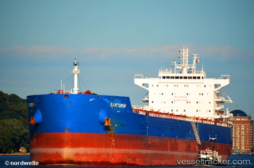
Santorini
Current StatusWhere is the vessel?
Santorini is currently in 243 nm SW of Sao Filipe, based on AIS data received about 10h ago.
Latest AIS update:
Current position: 12.01667° N, 27.42833° W (243 nm SW of Sao Filipe)
Average speed (last 7 days): Loading…
Average speed (last 30 days): Loading…
Vessel profile: Santorini is a Bulk Carrier with dimensions 32m x 229m.
This page combines live AIS, route history, probable destination signals, nearby traffic, and port activity for practical vessel monitoring.
The current position of vessel Santorini is 12.01667 lat / -27.42833 lng. Updated: 2026-04-10 07:46:43 UTCNearest reference points:
- Open sea, approx. 400 nm off the nearest listed port
- Open sea, approx. 403 nm off the nearest listed port
- Open sea, approx. 401 nm off the nearest listed port
Details:
Live Vessel Santorini Analytics (details, animations, etc.)
Recent AIS points (UTC):
2026-04-10 01:29:55 UTC · 11.02013, -27.76771 · SOG 10.2 kn · COG 21°2026-04-10 03:43:41 UTC · 11.38167, -27.64500 · SOG 10 kn · COG -1°
2026-04-10 06:01:44 UTC · 11.74833, -27.52333 · SOG 9 kn · COG -1°
2026-04-10 07:46:43 UTC · 12.01667, -27.42833 · SOG 9 kn · COG -1°