 vesseltracker.com
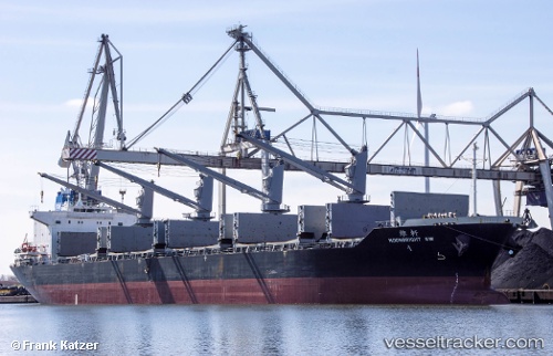
 Moonbright Sw
Current Status
Where is the vessel?
Moonbright Sw is currently in 231 nm NW of Amini Island, based on AIS data received about 1h ago.
Latest AIS update:
Current position: 13.76167° N, 69.87833° E (231 nm NW of Amini Island)
Average speed (last 7 days): Loading…
Average speed (last 30 days): Loading…
Vessel profile: Moonbright Sw is a Bulk Carrier with dimensions 176m x 28m.
This page combines live AIS, route history, probable destination signals, nearby traffic, and port activity for practical vessel monitoring.
The current position of vessel Moonbright Sw is 13.76167 lat / 69.87833 lng. Updated: 2026-03-31 13:09:37 UTCNearest reference points:
- 202 nm NW of Amini Island
- 198 nm N of Tinaquillo
- 187 nm N of Tinaquillo
Currently sailing under the flag of Panama ![]()
Moonbright Sw built in 2012 year
Deadweight:
36378 tDetails:
Live Vessel Moonbright Sw Analytics (details, animations, etc.)
Recent AIS points (UTC):
2026-03-31 08:15:37 UTC · 13.78500, 69.95667 · SOG 0 kn · COG -1°2026-03-31 10:06:35 UTC · 13.77500, 69.92667 · SOG 1 kn · COG -1°
2026-03-31 11:57:37 UTC · 13.76833, 69.89500 · SOG 0 kn · COG -1°
2026-03-31 13:09:37 UTC · 13.76167, 69.87833 · SOG 1 kn · COG -1°