 vesseltracker.com
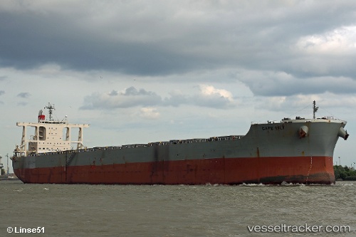
 Cape Lily
Current Status
Where is the vessel?
Cape Lily is currently in 22 nm SW of LIPATA, based on AIS data received about 1h ago.
Latest AIS update:
Current position: 9.64936° N, 125.11624° E (22 nm SW of LIPATA)
Average speed (last 7 days): Loading…
Average speed (last 30 days): Loading…
Vessel profile: Cape Lily is a Bulk Carrier with dimensions 292m x 45m.
This page combines live AIS, route history, probable destination signals, nearby traffic, and port activity for practical vessel monitoring.
The current position of vessel Cape Lily is 9.64936 lat / 125.11624 lng. Updated: 2026-04-03 19:33:10 UTCNearest reference points:
- Near Hilongos
- Near Taganito
- 16 nm E of Danao
Currently sailing under the flag of Singapore ![]()
Details:
Live Vessel Cape Lily Analytics (details, animations, etc.)
Recent AIS points (UTC):
2026-04-03 14:02:18 UTC · 9.04282, 124.51998 · SOG 12.4 kn · COG 348°2026-04-03 15:26:21 UTC · 9.28225, 124.54729 · SOG 10.6 kn · COG 56°
2026-04-03 17:39:30 UTC · 9.48020, 124.85322 · SOG 9.7 kn · COG 56°
2026-04-03 19:33:10 UTC · 9.64936, 125.11624 · SOG 9.9 kn · COG 58°