 vesseltracker.com
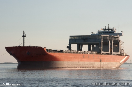
 SAGA FRAM
Current Status
Where is the vessel?
SAGA FRAM is currently in Near Camden, based on AIS data received about 1h ago.
Latest AIS update:
Current position: 39.92002° N, 75.13642° W (Near Camden)
Average speed (last 7 days): Loading…
Average speed (last 30 days): Loading…
Vessel profile: SAGA FRAM is a Cargo/Container Ship with dimensions m x m.
This page combines live AIS, route history, probable destination signals, nearby traffic, and port activity for practical vessel monitoring.
The current position of vessel SAGA FRAM is 39.92002 lat / -75.13642 lng. Updated: 2026-04-08 03:39:01 UTCNearest reference points:
- Near Brooklawn
- Near Trainer
- Near Wilmington
Currently sailing under the flag of Bahamas ![]()
Details:
Live Vessel SAGA FRAM Analytics (details, animations, etc.)
Recent AIS points (UTC):
2026-04-07 21:47:57 UTC · 39.92003, -75.13641 · SOG 0 kn · COG 279°2026-04-08 00:18:02 UTC · 39.92003, -75.13643 · SOG 0 kn · COG 279°
2026-04-08 02:15:00 UTC · 39.92002, -75.13642 · SOG 0 kn · COG 279°
2026-04-08 03:39:01 UTC · 39.92002, -75.13642 · SOG 0 kn · COG 279°