 vesseltracker.com
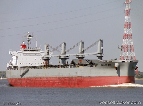
 BRITAIN BAY
Current Status
Where is the vessel?
BRITAIN BAY is currently in Near Campha, based on AIS data received about 1d ago.
Latest AIS update:
Current position: 20.97440° N, 107.35976° E (Near Campha)
Average speed (last 7 days): Loading…
Average speed (last 30 days): Loading…
Vessel profile: BRITAIN BAY is a Bulk Carrier with dimensions m x m.
This page combines live AIS, route history, probable destination signals, nearby traffic, and port activity for practical vessel monitoring.
The current position of vessel BRITAIN BAY is 20.97440 lat / 107.35976 lng. Updated: 2026-04-10 07:29:29 UTCNearest reference points:
- 13 nm E of Campha
- 18 nm SE of Ha Long
- 24 nm SE of Campha
Currently sailing under the flag of Singapore ![]()
Details:
Live Vessel BRITAIN BAY Analytics (details, animations, etc.)
Recent AIS points (UTC):
2026-04-10 01:35:29 UTC · 20.97263, 107.35962 · SOG 0.2 kn · COG 302°2026-04-10 04:11:29 UTC · 20.97453, 107.35967 · SOG 0.1 kn · COG 232°
2026-04-10 05:44:29 UTC · 20.97448, 107.35970 · SOG 0.1 kn · COG 233°
2026-04-10 07:29:29 UTC · 20.97440, 107.35976 · SOG 0.1 kn · COG 234°