 vesseltracker.com
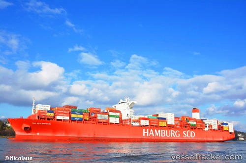
 Cap San Raphael
Current Status
Where is the vessel?
Cap San Raphael is currently in 393 nm S of Sao Filipe, based on AIS data received less than 1h ago.
Latest AIS update:
Current position: 8.41019° N, 25.40379° W (393 nm S of Sao Filipe)
Average speed (last 7 days): Loading…
Average speed (last 30 days): Loading…
Vessel profile: Cap San Raphael is a Container Ship with dimensions 333m x 48m.
This page combines live AIS, route history, probable destination signals, nearby traffic, and port activity for practical vessel monitoring.
The current position of vessel Cap San Raphael is 8.41019 lat / -25.40379 lng. Updated: 2026-03-30 19:58:56 UTCNearest reference points:
- Open sea, approx. 402 nm off the nearest listed port
- Open sea, approx. 403 nm off the nearest listed port
- Open sea (no nearby ports in database)
Currently sailing under the flag of Denmark ![]()
Cap San Raphael built in 2014 year
Deadweight:
124460 tDetails:
Live Vessel Cap San Raphael Analytics (details, animations, etc.)
Recent AIS points (UTC):
2026-03-30 13:47:29 UTC · 10.40051, -24.49685 · SOG 21.1 kn · COG 203°2026-03-30 15:35:37 UTC · 9.81500, -24.76167 · SOG 21 kn · COG -1°
2026-03-30 18:17:38 UTC · 8.94833, -25.17167 · SOG 20 kn · COG -1°
2026-03-30 19:58:56 UTC · 8.41019, -25.40379 · SOG 20.7 kn · COG 201°