 vesseltracker.com
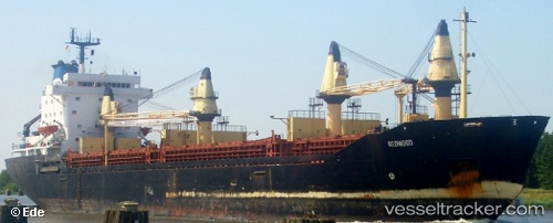
 MERCURIUS
Current Status
Where is the vessel?
MERCURIUS is currently in Near Maltepe, based on AIS data received about 8h ago.
Latest AIS update:
Current position: 40.80683° N, 28.95658° E (Near Maltepe)
Average speed (last 7 days): Loading…
Average speed (last 30 days): Loading…
Vessel profile: MERCURIUS is a Cargo with dimensions m x m.
This page combines live AIS, route history, probable destination signals, nearby traffic, and port activity for practical vessel monitoring.
The current position of vessel MERCURIUS is 40.80683 lat / 28.95658 lng. Updated: 2026-04-10 07:43:22 UTCNearest reference points:
- 10 nm SE of Kumport
- Near Kumport
- Near Maltepe
Currently sailing under the flag of Saint Kitts and Nevis ![]()
Details:
Live Vessel MERCURIUS Analytics (details, animations, etc.)
Recent AIS points (UTC):
2026-04-10 02:11:30 UTC · 40.96579, 28.89735 · SOG 0 kn · COG 137°2026-04-10 04:04:41 UTC · 40.88586, 28.93883 · SOG 6.8 kn · COG 166°
2026-04-10 05:34:10 UTC · 40.80291, 28.95682 · SOG 0.9 kn · COG 116°
2026-04-10 07:43:22 UTC · 40.80683, 28.95658 · SOG 2.8 kn · COG 59°