 vesseltracker.com
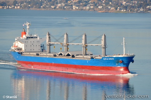
 ELIAS
ELIAS
Current Status
Where is the vessel?
ELIAS is currently in 26 nm N of Ile D’Ouessant, based on AIS data received less than 1h ago.
Latest AIS update:
Current position: 49.08544° N, 5.30761° W (26 nm N of Ile D’Ouessant)
Average speed (last 7 days): Loading…
Average speed (last 30 days): Loading…
Vessel profile: ELIAS is a Bulk Carrier with dimensions m x m.
This page combines live AIS, route history, probable destination signals, nearby traffic, and port activity for practical vessel monitoring.
The current position of vessel ELIAS is 49.08544 lat / -5.30761 lng. Updated: 2026-04-20 04:18:07 UTCNearest reference points:
- 18 nm NE of Ile D’Ouessant
- 34 nm W of Verzy
- 28 nm N of Landunvez
Currently sailing under the flag of Marshall Islands ![]()
Details:
Live Vessel ELIAS Analytics (details, animations, etc.)
Recent AIS points (UTC):
2026-04-20 01:38:16 UTC · 49.36171, -4.65534 · SOG 13 kn · COG 235°2026-04-20 01:47:58 UTC · 49.34311, -4.70061 · SOG 12.8 kn · COG 235°
2026-04-20 04:03:57 UTC · 49.10655, -5.25522 · SOG 10.3 kn · COG 235°
2026-04-20 04:18:07 UTC · 49.08544, -5.30761 · SOG 10.2 kn · COG 237°