 vesseltracker.com
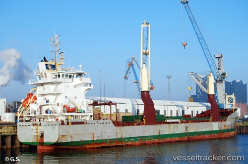
 Vectis Isle
Current Status
Where is the vessel?
Vectis Isle is currently in 15 nm NW of Thorntonbank, based on AIS data received less than 1h ago.
Latest AIS update:
Current position: 51.74405° N, 2.56527° E (15 nm NW of Thorntonbank)
Average speed (last 7 days): Loading…
Average speed (last 30 days): Loading…
Vessel profile: Vectis Isle is a Multi Purpose Carrier with dimensions 124m x 18m.
This page combines live AIS, route history, probable destination signals, nearby traffic, and port activity for practical vessel monitoring.
The current position of vessel Vectis Isle is 51.74405 lat / 2.56527 lng. Updated: 2026-04-02 09:57:44 UTCNearest reference points:
- 21 nm S of Craven Arms
- 13 nm NW of Middelkerke
- Near Thorntonbank
Currently sailing under the flag of United Kingdom ![]()
Vectis Isle built in 2012 year
Deadweight:
10199 tDetails:
Live Vessel Vectis Isle Analytics (details, animations, etc.)
Recent AIS points (UTC):
2026-04-02 03:45:53 UTC · 51.08329, 1.73529 · SOG 10.4 kn · COG 43°2026-04-02 05:52:22 UTC · 51.30842, 2.11887 · SOG 9.1 kn · COG 24°
2026-04-02 08:19:21 UTC · 51.58745, 2.36966 · SOG 7.3 kn · COG 36°
2026-04-02 09:57:44 UTC · 51.74405, 2.56527 · SOG 7.5 kn · COG 36°