 vesseltracker.com
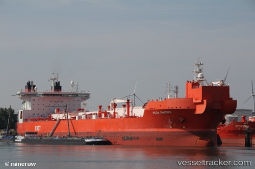
 Hilda Knutsen
Current Status
Where is the vessel?
Hilda Knutsen is currently in 29 nm SW of Tyrihans, based on AIS data received about 3h ago.
Latest AIS update:
Current position: 64.51511° N, 6.14877° E (29 nm SW of Tyrihans)
Average speed (last 7 days): Loading…
Average speed (last 30 days): Loading…
Vessel profile: Hilda Knutsen is a Crude Oil Tanker with dimensions 276m x 46m.
This page combines live AIS, route history, probable destination signals, nearby traffic, and port activity for practical vessel monitoring.
The current position of vessel Hilda Knutsen is 64.51511 lat / 6.14877 lng. Updated: 2026-03-31 16:16:49 UTCNearest reference points:
- Near Aukra
- Near Brattvåg
- Near ELNESVAGEN
Currently sailing under the flag of Norway ![]()
Hilda Knutsen built in 2013 year
Deadweight:
123166 tDetails:
Live Vessel Hilda Knutsen Analytics (details, animations, etc.)
Recent AIS points (UTC):
2026-03-31 12:01:04 UTC · 63.74570, 5.09587 · SOG 12.1 kn · COG 23°2026-03-31 13:26:14 UTC · 64.01378, 5.37232 · SOG 13.3 kn · COG 24°
2026-03-31 14:12:26 UTC · 64.16847, 5.51443 · SOG 12.6 kn · COG 26°
2026-03-31 16:16:49 UTC · 64.51511, 6.14877 · SOG 13.1 kn · COG 44°