 vesseltracker.com
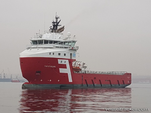
 STARLING TIDE
Current Status
Where is the vessel?
STARLING TIDE is currently in Near BAIA DE VITORIA, based on AIS data received about 1d ago.
Latest AIS update:
Current position: 20.43347° S, 40.20893° W (Near BAIA DE VITORIA)
Average speed (last 7 days): Loading…
Average speed (last 30 days): Loading…
Vessel profile: STARLING TIDE is a Offshore Supply Ship with dimensions m x m.
This page combines live AIS, route history, probable destination signals, nearby traffic, and port activity for practical vessel monitoring.
The current position of vessel STARLING TIDE is -20.43347 lat / -40.20893 lng. Updated: 2026-04-10 07:49:40 UTCNearest reference points:
- Near Tubarão Pt./Vitória
- Near JARDIM CAMBURI
- Near BAIA DE VITORIA
Details:
Live Vessel STARLING TIDE Analytics (details, animations, etc.)
Recent AIS points (UTC):
2026-04-10 02:03:23 UTC · -20.85544, -40.40106 · SOG 5.3 kn · COG 23°2026-04-10 03:20:49 UTC · -20.75333, -40.34500 · SOG 4 kn · COG -1°
2026-04-10 06:13:00 UTC · -20.54786, -40.24144 · SOG 4.4 kn · COG 20°
2026-04-10 07:49:40 UTC · -20.43347, -40.20893 · SOG 4.6 kn · COG 340°