 vesseltracker.com
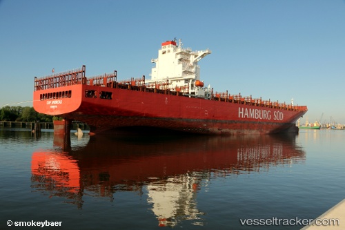
 Cap Andreas
Current Status
Where is the vessel?
Cap Andreas is currently in 43 nm SW of Offshore Ambrose, based on AIS data received about 1h ago.
Latest AIS update:
Current position: 39.86170° N, 72.82101° W (43 nm SW of Offshore Ambrose)
Average speed (last 7 days): Loading…
Average speed (last 30 days): Loading…
Vessel profile: Cap Andreas is a Container Ship with dimensions 271m x 43m.
This page combines live AIS, route history, probable destination signals, nearby traffic, and port activity for practical vessel monitoring.
The current position of vessel Cap Andreas is 39.86170 lat / -72.82101 lng. Updated: 2026-03-27 23:28:11 UTCNearest reference points:
- 13 nm E of Avon-by-the-Sea
- Near Springville, Suffolk
- Near Bellmore
Currently sailing under the flag of Liberia ![]()
Cap Andreas built in 2013 year
Deadweight:
80547 tDetails:
Live Vessel Cap Andreas Analytics (details, animations, etc.)
Recent AIS points (UTC):
2026-03-27 17:31:41 UTC · 39.20377, -71.86614 · SOG 10.3 kn · COG 318°2026-03-27 20:15:37 UTC · 39.55107, -72.28741 · SOG 10.7 kn · COG 327°
2026-03-27 21:21:11 UTC · 39.68871, -72.43420 · SOG 9.9 kn · COG 294°
2026-03-27 23:28:11 UTC · 39.86170, -72.82101 · SOG 9.7 kn · COG 309°