 vesseltracker.com
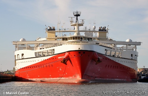
 RAMFORM ATLAS
Current Status
Where is the vessel?
RAMFORM ATLAS is currently in 31 nm SE of Homblières, based on AIS data received about 1h ago.
Latest AIS update:
Current position: 59.40017° N, 3.86255° E (31 nm SE of Homblières)
Average speed (last 7 days): Loading…
Average speed (last 30 days): Loading…
Vessel profile: RAMFORM ATLAS is a Research/Survey Vessel with dimensions m x m.
This page combines live AIS, route history, probable destination signals, nearby traffic, and port activity for practical vessel monitoring.
The current position of vessel RAMFORM ATLAS is 59.40017 lat / 3.86255 lng. Updated: 2026-04-19 19:51:26 UTCNearest reference points:
- Near Storøya
- Near HUSOYA
- Near Glesvær
Currently sailing under the flag of Bahamas ![]()
Details:
Live Vessel RAMFORM ATLAS Analytics (details, animations, etc.)
Recent AIS points (UTC):
2026-04-19 16:46:03 UTC · 59.05083, 3.92280 · SOG 1.9 kn · COG 336°2026-04-19 17:42:58 UTC · 59.13842, 3.90864 · SOG 7 kn · COG 355°
2026-04-19 19:48:36 UTC · 59.39388, 3.86253 · SOG 8 kn · COG 357°
2026-04-19 19:51:26 UTC · 59.40017, 3.86255 · SOG 7.9 kn · COG 357°