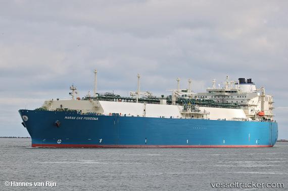
.
Vessel photo of Maran Gas Posidonia (IMO 9633434) vesseltracker.com

Maran Gas Posidonia

Vessel type: Lng Tanker | IMO: 9633434 | MMSI: MMSI: 241290000
Call sign: SVBW5 | Dimensions: 45 m x 289 m
Current Status

Where is the vessel?

Maran Gas Posidonia is currently in 78 nm W of Bangui, based on AIS data received about 3h ago.

Latest AIS update:

Current position: 18.97233° N, 119.45311° E (78 nm W of Bangui)

Average speed (last 7 days): Loading…

Average speed (last 30 days): Loading…

Vessel profile: Maran Gas Posidonia is a Lng Tanker with dimensions 45m x 289m.

This page combines live AIS, route history, probable destination signals, nearby traffic, and port activity for practical vessel monitoring.

The current position of vessel Maran Gas Posidonia is 18.97233 lat / 119.45311 lng. Updated: 2026-03-26 15:38:32 UTC
Nearest reference points:
  • 22 nm W of Salomague
  • 132 nm SW of Kaohsiung
  • 66 nm W of Basco
Details:

Live Vessel Maran Gas Posidonia Analytics (details, animations, etc.)


Recent AIS points (UTC):
2026-03-26 09:59:43 UTC · 19.94761, 120.38501 · SOG 12.3 kn · COG -1°
2026-03-26 11:24:57 UTC · 19.71965, 120.16630 · SOG 12.8 kn · COG -1°
2026-03-26 14:02:29 UTC · 19.29235, 119.72497 · SOG 14.9 kn · COG -1°
2026-03-26 15:38:32 UTC · 18.97233, 119.45311 · SOG 16 kn · COG -1°

Track of the vessel in the last 28 days


UTC: --
Start: -- Track timeline (UTC) End: --
Encountered: --


Link to the map:


Find another ship

Maran_Gas_Posidonia (241290000) last ports (portcalls and passsages)

Yokkaichi | 2025-09-06 00:01:11
BINTULU | 2025-08-26 11:04:38
BINTULU | 2025-07-23 05:11:29
XIUYU | 2025-07-14 00:13:02
TANGGUH | 2025-07-06 23:19:23
XIUYU | 2025-06-29 00:24:17
TANGGUH | 2025-06-22 04:00:56
TANGGUH | 2025-05-30 03:16:21
SUMOTO | 2025-05-17 10:29:37
HIMEJI | 2025-05-16 00:59:04
AKASHI | 2025-05-15 22:58:33
KADA | 2025-05-15 20:55:19
XIUYU | 2025-04-17 06:25:42
TANGGUH | 2025-04-08 10:34:51
Yokohama | 2025-03-18 05:46:57
KIMITSU | 2025-03-17 02:59:00
DAHEJ | 2025-02-14 23:19:18
BUKOM ISLAND | 2025-01-22 01:44:45
JURONG ISLAND | 2025-01-22 01:23:33
LHOKSEUMAWE | 2025-01-18 17:13:27
XIUYU | 2024-12-29 09:11:14
TANGGUH | 2024-12-21 23:54:36
Map Ta Phut | 2024-12-09 23:07:53
BINTULU | 2024-11-12 19:55:42
Selat Lombok | 2024-09-29 02:44:30
Yosu | 2024-08-31 23:23:20
Sambu | 2024-04-23 00:38:48
Das Island | 2024-03-29 01:48:48
Map Ta Phut | 2024-01-05 01:12:48
Singapore | 2023-12-24 09:11:07
Singapore | 2023-10-23 21:25:20
Map Ta Phut | 2023-09-29 00:07:15
Port Louis | 2023-09-18 18:53:59
Singapore | 2023-07-16 08:33:40
Sambu | 2023-06-26 01:36:26
Singapore | 2023-06-08 14:25:05
Singapore | 2023-05-10 20:53:23
Ras Gharib | 2023-04-28 21:37:07
Bur Ibrahim | 2023-04-28 14:50:47
Port Said | 2023-04-28 05:08:18
Algeciras | 2023-03-21 05:49:57
Cartagena | 2023-03-19 03:11:01
Bee Ness | 2023-02-17 08:16:08
Sheerness | 2023-02-17 05:44:04
Falmouth | 2023-01-01 11:46:48
Huelva | 2022-10-24 13:28:38
Strait Of Gibraltar | 2022-10-23 13:43:13
Algeciras | 2022-10-22 13:38:51
Algeciras | 2022-09-24 01:57:34
Huelva | 2022-09-22 01:34:12
Skagens Odde | 2022-08-27 07:37:13
Korsor | 2022-08-26 19:57:17
Klaipeda | 2022-08-25 04:37:54
Huelva | 2022-07-24 23:12:23
Milford Haven | 2022-06-25 10:13:20
Bishop Rock | 2022-06-23 19:54:01
Strait Of Gibraltar | 2022-05-17 19:24:46
Livorno | 2022-05-10 13:29:47
Livorno | 2022-05-06 13:18:38
Livorno | 2022-05-02 12:51:16
Algeciras | 2022-03-26 09:50:17
Huelva | 2022-03-23 05:44:14
Sheerness | 2022-02-23 03:25:27
Sheerness | 2022-02-22 03:01:31
Strait Of Gibraltar | 2022-01-21 00:25:28
Algeciras | 2022-01-20 18:35:25
Algeciras | 2022-01-16 22:35:16
Strait Of Gibraltar | 2022-01-15 11:02:42
Milford Haven | 2022-01-10 13:20:20
Port Said | 2021-12-07 15:45:04