 vesseltracker.com
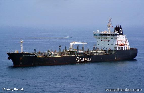
 KINGBIRD ARROW
Current Status
Where is the vessel?
KINGBIRD ARROW is currently in 40 nm NE of AL SUWAIQ, based on AIS data received about 17h ago.
Latest AIS update:
Current position: 24.45629° N, 57.76583° E (40 nm NE of AL SUWAIQ)
Average speed (last 7 days): Loading…
Average speed (last 30 days): Loading…
Vessel profile: KINGBIRD ARROW is a Tanker with dimensions m x m.
This page combines live AIS, route history, probable destination signals, nearby traffic, and port activity for practical vessel monitoring.
The current position of vessel KINGBIRD ARROW is 24.45629 lat / 57.76583 lng. Updated: 2026-04-10 05:54:01 UTCNearest reference points:
- 58 nm S of JASK
- 42 nm SE of Offshore Fujairah
- 18 nm SE of SHINAS
Currently sailing under the flag of Marshall Islands ![]()
Details:
Live Vessel KINGBIRD ARROW Analytics (details, animations, etc.)
Recent AIS points (UTC):
2026-04-10 01:40:28 UTC · 24.09500, 58.56333 · SOG 12 kn · COG -1°2026-04-10 03:55:33 UTC · 24.33500, 58.15500 · SOG 11 kn · COG -1°
2026-04-10 05:54:01 UTC · 24.45629, 57.76583 · SOG 11.6 kn · COG 284°
2026-04-10 05:54:01 UTC · 24.45629, 57.76583 · SOG 11.6 kn · COG 284°