 vesseltracker.com
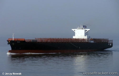
 Mary
Mary
Current Status
Where is the vessel?
Mary is currently in 193 nm E of Benahavis, based on AIS data received less than 1h ago.
Latest AIS update:
Current position: 35.63833° N, 46.66500° W (193 nm E of Benahavis)
Average speed (last 7 days): Loading…
Average speed (last 30 days): Loading…
Vessel profile: Mary is a Container Ship with dimensions 270m x 43m.
This page combines live AIS, route history, probable destination signals, nearby traffic, and port activity for practical vessel monitoring.
The current position of vessel Mary is 35.63833 lat / -46.66500 lng. Updated: 2026-03-30 03:20:08 UTCCurrently sailing under the flag of Marshall Is ![]()
Mary built in 2013 year
Deadweight:
80274 tDetails:
Live Vessel Mary Analytics (details, animations, etc.)
Recent AIS points (UTC):
2026-03-29 21:26:07 UTC · 35.40667, -48.05833 · SOG 11 kn · COG -1°2026-03-30 00:20:07 UTC · 35.49667, -47.37833 · SOG 11 kn · COG -1°
2026-03-30 01:49:39 UTC · 35.57726, -47.03312 · SOG 11.8 kn · COG 76°
2026-03-30 03:20:08 UTC · 35.63833, -46.66500 · SOG 12 kn · COG -1°