 vesseltracker.com
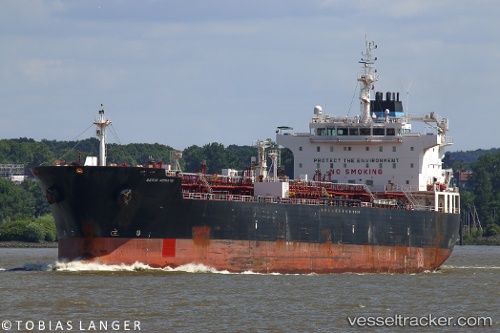
 MAERSK ADRIATIC
Current Status
Where is the vessel?
MAERSK ADRIATIC is currently in 29 nm S of CARBONERAS, based on AIS data received less than 1h ago.
Latest AIS update:
Current position: 36.49695° N, 1.76070° W (29 nm S of CARBONERAS)
Average speed (last 7 days): Loading…
Average speed (last 30 days): Loading…
Vessel profile: MAERSK ADRIATIC is a Oil/Chemical Tanker with dimensions m x m.
This page combines live AIS, route history, probable destination signals, nearby traffic, and port activity for practical vessel monitoring.
The current position of vessel MAERSK ADRIATIC is 36.49695 lat / -1.76070 lng. Updated: 2026-03-29 14:17:15 UTCNearest reference points:
- 20 nm SE of CARBONERAS
- 27 nm SE of El Alquian
- 26 nm S of El Alquian
Currently sailing under the flag of Denmark ![]()
Details:
Live Vessel MAERSK ADRIATIC Analytics (details, animations, etc.)
Recent AIS points (UTC):
2026-03-29 08:21:26 UTC · 37.25667, -0.64500 · SOG 12 kn · COG -1°2026-03-29 09:44:41 UTC · 37.07167, -0.89792 · SOG 11.6 kn · COG 224°
2026-03-29 11:33:23 UTC · 36.82667, -1.21333 · SOG 11 kn · COG -1°
2026-03-29 14:17:15 UTC · 36.49695, -1.76070 · SOG 12 kn · COG 230°