 vesseltracker.com
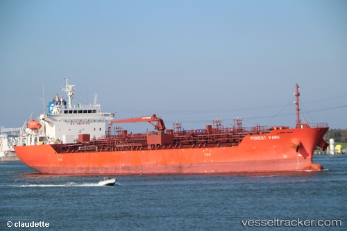
 XING TONG KAI YUAN
Current Status
Where is the vessel?
XING TONG KAI YUAN is currently in 44 nm SW of Yanbu, based on AIS data received less than 1h ago.
Latest AIS update:
Current position: 23.45391° N, 37.58438° E (44 nm SW of Yanbu)
Average speed (last 7 days): Loading…
Average speed (last 30 days): Loading…
Vessel profile: XING TONG KAI YUAN is a Oil/Chemical Tanker with dimensions m x m.
This page combines live AIS, route history, probable destination signals, nearby traffic, and port activity for practical vessel monitoring.
The current position of vessel XING TONG KAI YUAN is 23.45391 lat / 37.58438 lng. Updated: 2026-04-13 02:37:01 UTCNearest reference points:
- 30 nm SW of Yanbu
- 74 nm SW of Yanbu
- 35 nm S of Umm Lajj
Currently sailing under the flag of China ![]()
Details:
Live Vessel XING TONG KAI YUAN Analytics (details, animations, etc.)
Recent AIS points (UTC):
2026-04-12 19:28:25 UTC · 23.94803, 36.74682 · SOG 12.9 kn · COG 151°2026-04-12 21:26:40 UTC · 23.56156, 36.96684 · SOG 13.3 kn · COG 156°
2026-04-13 00:01:42 UTC · 23.13582, 37.41125 · SOG 13.9 kn · COG 138°
2026-04-13 02:37:01 UTC · 23.45391, 37.58438 · SOG 11.5 kn · COG 10°