 vesseltracker.com
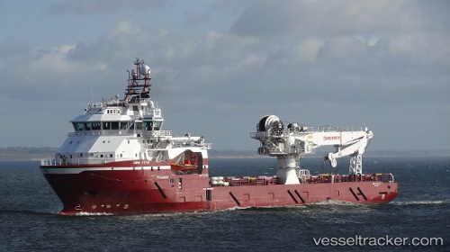
 DINA STAR
Current Status
Where is the vessel?
DINA STAR is currently in Near Storesund, based on AIS data received about 1h ago.
Latest AIS update:
Current position: 59.42187° N, 5.25474° E (Near Storesund)
Average speed (last 7 days): Loading…
Average speed (last 30 days): Loading…
Vessel profile: DINA STAR is a Offshore Supply Ship with dimensions m x m.
This page combines live AIS, route history, probable destination signals, nearby traffic, and port activity for practical vessel monitoring.
The current position of vessel DINA STAR is 59.42187 lat / 5.25474 lng. Updated: 2026-03-28 15:44:00 UTCNearest reference points:
- Near Storøya
- Near HUSOYA
- Near Valevåg
Currently sailing under the flag of Portugal ![]()
Details:
Live Vessel DINA STAR Analytics (details, animations, etc.)
Recent AIS points (UTC):
2026-03-28 09:37:58 UTC · 59.42188, 5.25472 · SOG 0 kn · COG 68°2026-03-28 12:32:00 UTC · 59.42186, 5.25469 · SOG 0 kn · COG 68°
2026-03-28 13:58:59 UTC · 59.42186, 5.25473 · SOG 0 kn · COG 68°
2026-03-28 15:44:00 UTC · 59.42187, 5.25474 · SOG 0 kn · COG 68°