 vesseltracker.com
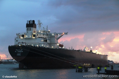
Al Yarmouk
Current StatusWhere is the vessel?
Al Yarmouk is currently in 15 nm E of Mina Abd Allah, based on AIS data received about 3d ago.
Latest AIS update:
Current position: 29.00118° N, 48.49282° E (15 nm E of Mina Abd Allah)
Average speed (last 7 days): Loading…
Average speed (last 30 days): Loading…
Vessel profile: Al Yarmouk is a Crude Oil Tanker with dimensions 60m x 333m.
This page combines live AIS, route history, probable destination signals, nearby traffic, and port activity for practical vessel monitoring.
The current position of vessel Al Yarmouk is 29.00118 lat / 48.49282 lng. Updated: 2026-03-31 06:37:18 UTCNearest reference points:
- Near Mina Al Zour
- Near SHUAIBA
- Near Mina Az Zawr
Details:
Live Vessel Al Yarmouk Analytics (details, animations, etc.)
Recent AIS points (UTC):
2026-03-31 06:01:18 UTC · 29.00098, 48.49235 · SOG 0.1 kn · COG 119°2026-03-31 06:37:18 UTC · 29.00118, 48.49282 · SOG 0 kn · COG 138°
2026-03-31 06:37:18 UTC · 29.00118, 48.49282 · SOG 0 kn · COG 138°
2026-03-31 06:37:18 UTC · 29.00118, 48.49282 · SOG 0 kn · COG 138°