 vesseltracker.com
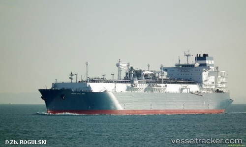
Hoegh Gallant
Current StatusWhere is the vessel?
Hoegh Gallant is currently in Near Old Harbour, based on AIS data received about 1h ago.
Latest AIS update:
Current position: 17.84479° N, 77.11703° W (Near Old Harbour)
Average speed (last 7 days): Loading…
Average speed (last 30 days): Loading…
Vessel profile: Hoegh Gallant is a Fsru Tanker with dimensions 46m x 294m.
This page combines live AIS, route history, probable destination signals, nearby traffic, and port activity for practical vessel monitoring.
The current position of vessel Hoegh Gallant is 17.84479 lat / -77.11703 lng. Updated: 2026-03-27 06:04:16 UTCNearest reference points:
- 16 nm SE of Ceiba Hueca
Details:
Live Vessel Hoegh Gallant Analytics (details, animations, etc.)
Recent AIS points (UTC):
2026-03-26 23:34:11 UTC · 17.84481, -77.11704 · SOG 0 kn · COG 135°2026-03-27 02:04:14 UTC · 17.84485, -77.11702 · SOG 0 kn · COG 135°
2026-03-27 03:34:14 UTC · 17.84480, -77.11706 · SOG 0 kn · COG 135°
2026-03-27 06:04:16 UTC · 17.84479, -77.11703 · SOG 0 kn · COG 135°