 vesseltracker.com
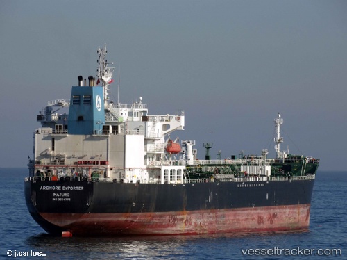
Ardmore Exporter
Current StatusWhere is the vessel?
Ardmore Exporter is currently in 33 nm SW of Cape Of Good Hope, based on AIS data received less than 1h ago.
Latest AIS update:
Current position: 34.71774° S, 17.86328° E (33 nm SW of Cape Of Good Hope)
Average speed (last 7 days): Loading…
Average speed (last 30 days): Loading…
Vessel profile: Ardmore Exporter is a Chemical Oil Products Tanker with dimensions 32m x 183m.
This page combines live AIS, route history, probable destination signals, nearby traffic, and port activity for practical vessel monitoring.
The current position of vessel Ardmore Exporter is -34.71774 lat / 17.86328 lng. Updated: 2026-03-31 03:26:53 UTCNearest reference points:
- 18 nm SW of Cape Of Good Hope
- Near HOUT BAY
- 12 nm W of ROBBEN ISLAND
Details:
Live Vessel Ardmore Exporter Analytics (details, animations, etc.)
Recent AIS points (UTC):
2026-03-30 21:59:59 UTC · -35.24777, 19.23859 · SOG 13.5 kn · COG 269°2026-03-30 23:52:28 UTC · -35.13177, 18.73988 · SOG 14.2 kn · COG 290°
2026-03-31 02:02:04 UTC · -34.92436, 18.17754 · SOG 14 kn · COG 309°
2026-03-31 03:26:53 UTC · -34.71774, 17.86328 · SOG 14.2 kn · COG 310°