 vesseltracker.com
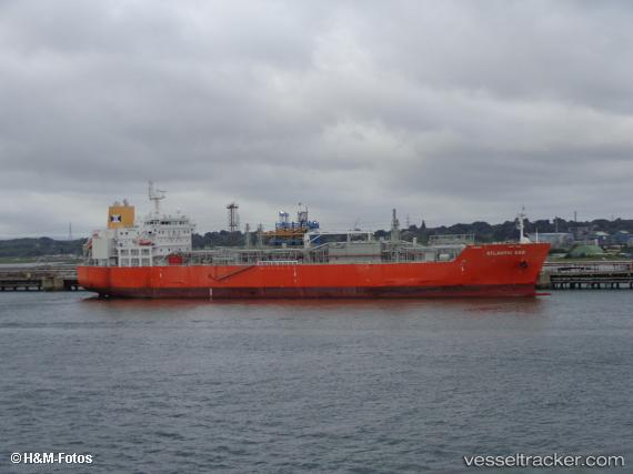
Atlanticgas
Current StatusWhere is the vessel?
Atlanticgas is currently in 99 nm N of Cap Malheureux, based on AIS data received about 1h ago.
Latest AIS update:
Current position: 18.34186° S, 57.71707° E (99 nm N of Cap Malheureux)
Average speed (last 7 days): Loading…
Average speed (last 30 days): Loading…
Vessel profile: Atlanticgas is a Lpg Tanker with dimensions 27m x 160m.
This page combines live AIS, route history, probable destination signals, nearby traffic, and port activity for practical vessel monitoring.
The current position of vessel Atlanticgas is -18.34186 lat / 57.71707 lng. Updated: 2026-03-26 22:18:30 UTCNearest reference points:
- Near Port Louis
- 164 nm NW of Pointe aux Canonniers
Details:
Live Vessel Atlanticgas Analytics (details, animations, etc.)
Recent AIS points (UTC):
2026-03-26 15:27:30 UTC · -16.73858, 58.21181 · SOG 14.3 kn · COG 196°2026-03-26 18:19:29 UTC · -17.38833, 58.01167 · SOG 14 kn · COG -1°
2026-03-26 19:53:57 UTC · -17.76024, 57.88769 · SOG 15 kn · COG 193°
2026-03-26 22:18:30 UTC · -18.34186, 57.71707 · SOG 14.7 kn · COG 190°