 vesseltracker.com
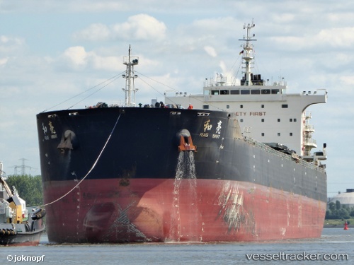
 AGRI BRIGHT
Current Status
Where is the vessel?
AGRI BRIGHT is currently in 24 nm W of Westport/Port Klang, based on AIS data received about 2h ago.
Latest AIS update:
Current position: 2.93364° N, 100.89513° E (24 nm W of Westport/Port Klang)
Average speed (last 7 days): Loading…
Average speed (last 30 days): Loading…
Vessel profile: AGRI BRIGHT is a Bulk Carrier with dimensions 225m x 32m.
This page combines live AIS, route history, probable destination signals, nearby traffic, and port activity for practical vessel monitoring.
The current position of vessel AGRI BRIGHT is 2.93364 lat / 100.89513 lng. Updated: 2026-04-02 06:46:36 UTCNearest reference points:
- 21 nm SW of Pulau Indah
- Near Westport/Port Klang
- Near Pulau Indah
Currently sailing under the flag of Marshall Islands ![]()
AGRI BRIGHT built in 2013 year
Deadweight:
74632 tDetails:
Live Vessel AGRI BRIGHT Analytics (details, animations, etc.)
Recent AIS points (UTC):
2026-04-02 02:25:35 UTC · 2.50388, 101.59471 · SOG 10.2 kn · COG 307°2026-04-02 03:30:08 UTC · 2.61947, 101.43788 · SOG 11.5 kn · COG -1°
2026-04-02 05:56:31 UTC · 2.83684, 101.00125 · SOG 11.3 kn · COG -1°
2026-04-02 06:46:36 UTC · 2.93364, 100.89513 · SOG 9.6 kn · COG -1°