 West Bollsta
Current Status
Where is the vessel?
West Bollsta is currently in 17 nm S of Grane, based on AIS data received about 14h ago.
Latest AIS update:
Current position: 58.87991° N, 2.48726° E (17 nm S of Grane)
Average speed (last 7 days): Loading…
Average speed (last 30 days): Loading…
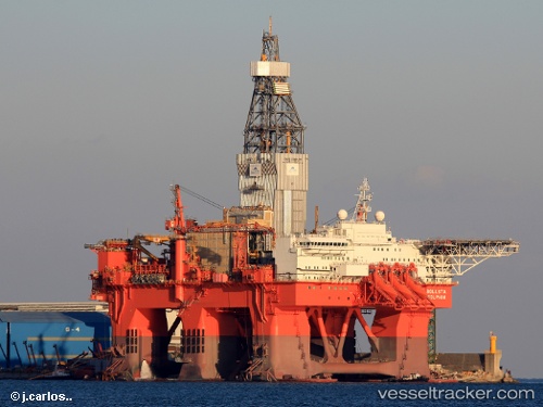
Vessel profile: West Bollsta is a Drilling Ship with dimensions 122m x 76m.
This page combines live AIS, route history, probable destination signals, nearby traffic, and port activity for practical vessel monitoring.
The current position of vessel West Bollsta is 58.87991 lat / 2.48726 lng. Updated: 2026-05-24 05:37:50 UTCNearest reference points:
- 10 nm N of Leadon
- Near Alba Oil Field
- 19 nm W of Curlew
Currently sailing under the flag of Norway ![]()
Details:
Live Vessel West Bollsta Analytics (details, animations, etc.)
Recent AIS points (UTC):
2026-05-24 01:37:38 UTC · 58.88004, 2.48752 · SOG 0 kn · COG 123°2026-05-24 04:04:40 UTC · 58.87991, 2.48740 · SOG 0 kn · COG 123°
2026-05-24 04:19:47 UTC · 58.88001, 2.48734 · SOG 0 kn · COG 123°
2026-05-24 05:37:50 UTC · 58.87991, 2.48726 · SOG 0 kn · COG 123°