 vesseltracker.com
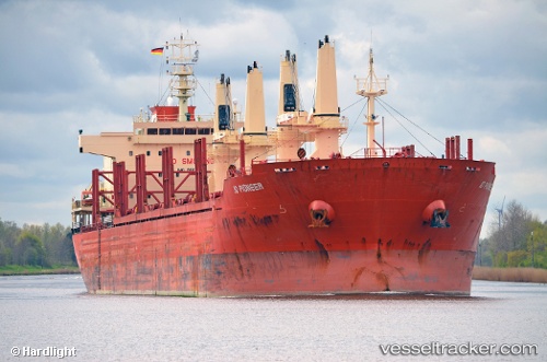
 WEST HARMONY
Current Status
Where is the vessel?
WEST HARMONY is currently in 314 nm S of Ben Slimane, based on AIS data received about 1h ago.
Latest AIS update:
Current position: 28.53165° N, 69.67306° W (314 nm S of Ben Slimane)
Average speed (last 7 days): Loading…
Average speed (last 30 days): Loading…
Vessel profile: WEST HARMONY is a Bulk Carrier with dimensions m x m.
This page combines live AIS, route history, probable destination signals, nearby traffic, and port activity for practical vessel monitoring.
The current position of vessel WEST HARMONY is 28.53165 lat / -69.67306 lng. Updated: 2026-04-03 12:18:49 UTCCurrently sailing under the flag of Liberia ![]()
Details:
Live Vessel WEST HARMONY Analytics (details, animations, etc.)
Recent AIS points (UTC):
2026-04-03 05:24:30 UTC · 29.10495, -68.24223 · SOG 11.8 kn · COG 243°2026-04-03 06:55:40 UTC · 28.98110, -68.56258 · SOG 12.2 kn · COG 246°
2026-04-03 08:59:29 UTC · 28.81110, -68.99733 · SOG 12 kn · COG 247°
2026-04-03 12:18:49 UTC · 28.53165, -69.67306 · SOG 11.6 kn · COG 247°