 vesseltracker.com
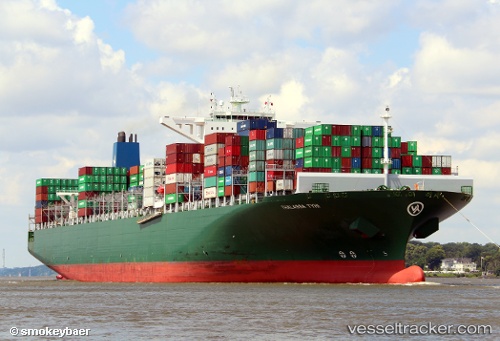
 Thalassa Tyhi
Current Status
Where is the vessel?
Thalassa Tyhi is currently in 26 nm E of Ceuta, based on AIS data received less than 1h ago.
Latest AIS update:
Current position: 35.91506° N, 4.78353° W (26 nm E of Ceuta)
Average speed (last 7 days): Loading…
Average speed (last 30 days): Loading…
Vessel profile: Thalassa Tyhi is a Container Ship with dimensions 368m x 51m.
This page combines live AIS, route history, probable destination signals, nearby traffic, and port activity for practical vessel monitoring.
The current position of vessel Thalassa Tyhi is 35.91506 lat / -4.78353 lng. Updated: 2026-04-09 21:27:10 UTCNearest reference points:
- 30 nm E of Ceuta
- Near Waterport
- 31 nm SE of Fuengirola
Currently sailing under the flag of Liberia ![]()
Thalassa Tyhi built in 2014 year
Deadweight:
131862 tDetails:
Live Vessel Thalassa Tyhi Analytics (details, animations, etc.)
Recent AIS points (UTC):
2026-04-09 15:31:39 UTC · 35.90022, -4.83384 · SOG 0.9 kn · COG 349°2026-04-09 18:15:50 UTC · 35.93047, -4.82777 · SOG 0.5 kn · COG 6°
2026-04-09 19:22:29 UTC · 35.93002, -4.81699 · SOG 0.5 kn · COG 35°
2026-04-09 21:27:10 UTC · 35.91506, -4.78353 · SOG 0.9 kn · COG 14°