 vesseltracker.com
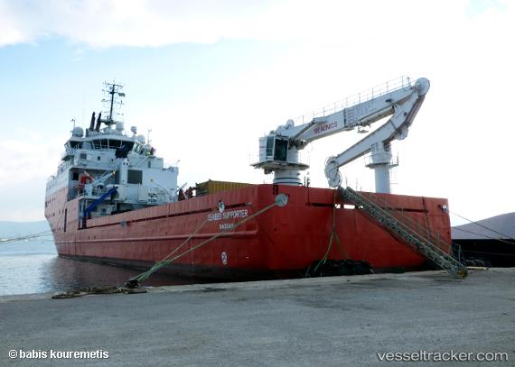
 NORSIDE SUPPORTER
Current Status
Where is the vessel?
NORSIDE SUPPORTER is currently in Near VONDELINGENPLAAT - ROTTERDAM, based on AIS data received less than 1h ago.
Latest AIS update:
Current position: 51.90106° N, 4.37246° E (Near VONDELINGENPLAAT - ROTTERDAM)
Average speed (last 7 days): Loading…
Average speed (last 30 days): Loading…
Vessel profile: NORSIDE SUPPORTER is a Other Type with dimensions m x m.
This page combines live AIS, route history, probable destination signals, nearby traffic, and port activity for practical vessel monitoring.
The current position of vessel NORSIDE SUPPORTER is 51.90106 lat / 4.37246 lng. Updated: 2026-03-30 10:00:14 UTCNearest reference points:
- Near VONDELINGENPLAAT - ROTTERDAM
- Near Pernis
- Near ROTTERDAM PERNIS
Currently sailing under the flag of Bahamas ![]()
Details:
Live Vessel NORSIDE SUPPORTER Analytics (details, animations, etc.)
Recent AIS points (UTC):
2026-03-30 03:42:18 UTC · 51.90106, 4.37246 · SOG 0 kn · COG 285°2026-03-30 05:24:16 UTC · 51.90107, 4.37246 · SOG 0 kn · COG 286°
2026-03-30 07:57:18 UTC · 51.90107, 4.37246 · SOG 0.1 kn · COG 286°
2026-03-30 10:00:14 UTC · 51.90106, 4.37246 · SOG 0 kn · COG 286°