 vesseltracker.com
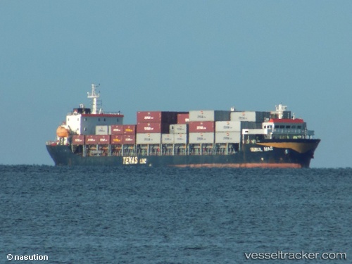
 UMBUL MAS
Current Status
Where is the vessel?
UMBUL MAS is currently in 18 nm NE of Perawang, based on AIS data received about 1h ago.
Latest AIS update:
Current position: 1.34167° N, 102.99667° E (18 nm NE of Perawang)
Average speed (last 7 days): Loading…
Average speed (last 30 days): Loading…
Vessel profile: UMBUL MAS is a Container Ship with dimensions m x m.
This page combines live AIS, route history, probable destination signals, nearby traffic, and port activity for practical vessel monitoring.
The current position of vessel UMBUL MAS is 1.34167 lat / 102.99667 lng. Updated: 2026-03-30 09:22:13 UTCNearest reference points:
- 17 nm NE of Perawang
- 19 nm W of Tanjong Bin
- 15 nm W of Tanjong Bin
Currently sailing under the flag of Indonesia ![]()
UMBUL MAS built in 2012 year
Deadweight:
8180 tDetails:
Live Vessel UMBUL MAS Analytics (details, animations, etc.)
Recent AIS points (UTC):
2026-03-30 04:00:19 UTC · 0.82748, 103.59068 · SOG 9.7 kn · COG -1°2026-03-30 05:54:34 UTC · 1.08881, 103.46625 · SOG 9.1 kn · COG -1°
2026-03-30 08:14:05 UTC · 1.24262, 103.14791 · SOG 9.5 kn · COG -1°
2026-03-30 09:22:13 UTC · 1.34167, 102.99667 · SOG 9 kn · COG -1°