 vesseltracker.com
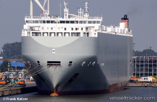
 Gravity Highway
Current Status
Where is the vessel?
Gravity Highway is currently in 132 nm W of Cedros Island, based on AIS data received less than 1h ago.
Latest AIS update:
Current position: 27.75598° N, 117.66457° W (132 nm W of Cedros Island)
Average speed (last 7 days): Loading…
Average speed (last 30 days): Loading…
Vessel profile: Gravity Highway is a Vehicles Carrier with dimensions 200m x 32m.
This page combines live AIS, route history, probable destination signals, nearby traffic, and port activity for practical vessel monitoring.
The current position of vessel Gravity Highway is 27.75598 lat / -117.66457 lng. Updated: 2026-03-30 06:01:49 UTCCurrently sailing under the flag of Bahamas ![]()
Gravity Highway built in 2014 year
Deadweight:
19974 tDetails:
Live Vessel Gravity Highway Analytics (details, animations, etc.)
Recent AIS points (UTC):
2026-03-29 23:21:53 UTC · 26.74500, -116.12333 · SOG 14 kn · COG -1°2026-03-30 02:23:14 UTC · 27.20626, -116.82135 · SOG 15.4 kn · COG 304°
2026-03-30 03:59:26 UTC · 27.44739, -117.19346 · SOG 15 kn · COG 307°
2026-03-30 06:01:49 UTC · 27.75598, -117.66457 · SOG 15.2 kn · COG 306°