 vesseltracker.com
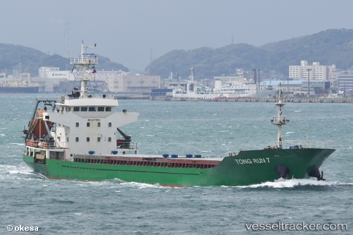
 TONG RUN 7
Current Status
Where is the vessel?
TONG RUN 7 is currently in Near Kamisu, Ibaraki, based on AIS data received less than 1h ago.
Latest AIS update:
Current position: 35.88167° N, 140.68500° E (Near Kamisu, Ibaraki)
Average speed (last 7 days): Loading…
Average speed (last 30 days): Loading…
Vessel profile: TONG RUN 7 is a Cargo with dimensions m x m.
This page combines live AIS, route history, probable destination signals, nearby traffic, and port activity for practical vessel monitoring.
The current position of vessel TONG RUN 7 is 35.88167 lat / 140.68500 lng. Updated: 2026-03-31 10:02:06 UTCNearest reference points:
- Near KASHIMA
- 12 nm E of CHOSHI
- Near Mito
Currently sailing under the flag of Panama ![]()
Details:
Live Vessel TONG RUN 7 Analytics (details, animations, etc.)
Recent AIS points (UTC):
2026-03-31 03:50:04 UTC · 35.88167, 140.68500 · SOG 0 kn · COG -1°2026-03-31 06:11:04 UTC · 35.88167, 140.68500 · SOG 0 kn · COG -1°
2026-03-31 07:17:04 UTC · 35.88167, 140.68500 · SOG 0 kn · COG -1°
2026-03-31 10:02:06 UTC · 35.88167, 140.68500 · SOG 0 kn · COG -1°