 vesseltracker.com
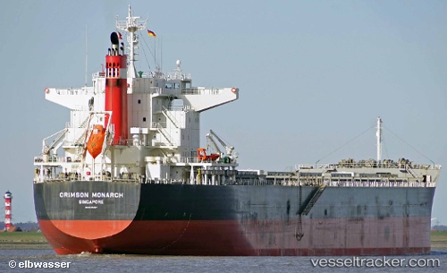
 SAINT MYRON
Current Status
Where is the vessel?
SAINT MYRON is currently in 395 nm E of Suqutrá, based on AIS data received about 1h ago.
Latest AIS update:
Current position: 10.24140° N, 60.29850° E (395 nm E of Suqutrá)
Average speed (last 7 days): Loading…
Average speed (last 30 days): Loading…
Vessel profile: SAINT MYRON is a Bulk Carrier with dimensions 224m x 32m.
This page combines live AIS, route history, probable destination signals, nearby traffic, and port activity for practical vessel monitoring.
The current position of vessel SAINT MYRON is 10.2414 lat / 60.2985 lng. Updated: 2026-04-13 09:23:57 UTCNearest reference points:
- Open sea, approx. 401 nm off the nearest listed port
- Open sea, approx. 402 nm off the nearest listed port
- Open sea, approx. 406 nm off the nearest listed port
Currently sailing under the flag of Malta ![]()
SAINT MYRON built in 2014 year
Deadweight:
77116 tDetails:
Live Vessel SAINT MYRON Analytics (details, animations, etc.)
Recent AIS points (UTC):
2026-04-13 03:29:50 UTC · 11.22690, 60.55280 · SOG 11.1 kn · COG 177°2026-04-13 05:55:49 UTC · 10.77680, 60.58030 · SOG 11.2 kn · COG 181°
2026-04-13 08:07:39 UTC · 10.42960, 60.42980 · SOG 10.5 kn · COG 217°
2026-04-13 09:23:57 UTC · 10.24140, 60.29850 · SOG 10.8 kn · COG 218°