 vesseltracker.com
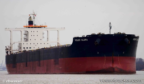
 Mount Uluru
Current Status
Where is the vessel?
Mount Uluru is currently in 27 nm SE of DONGJIAKOU, based on AIS data received about 1h ago.
Latest AIS update:
Current position: 35.24605° N, 120.15617° E (27 nm SE of DONGJIAKOU)
Average speed (last 7 days): Loading…
Average speed (last 30 days): Loading…
Vessel profile: Mount Uluru is a Bulk Carrier with dimensions 292m x 45m.
This page combines live AIS, route history, probable destination signals, nearby traffic, and port activity for practical vessel monitoring.
The current position of vessel Mount Uluru is 35.24605 lat / 120.15617 lng. Updated: 2026-04-02 13:53:04 UTCNearest reference points:
- 25 nm SE of DONGJIAKOU
- 24 nm SE of DONGJIAKOU
- 23 nm SE of Rizhao
Currently sailing under the flag of Liberia ![]()
Mount Uluru built in 2014 year
Deadweight:
181513 tDetails:
Live Vessel Mount Uluru Analytics (details, animations, etc.)
Recent AIS points (UTC):
2026-04-02 07:44:44 UTC · 35.58612, 119.79107 · SOG 0 kn · COG 146°2026-04-02 09:35:04 UTC · 35.58624, 119.79091 · SOG 0 kn · COG -1°
2026-04-02 11:43:14 UTC · 35.51109, 119.81003 · SOG 10.8 kn · COG 170°
2026-04-02 13:53:04 UTC · 35.24605, 120.15617 · SOG 11.6 kn · COG 136°