 vesseltracker.com
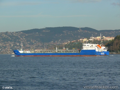
Truvor
Current StatusWhere is the vessel?
Truvor is currently in 16 nm NW of Batumi, based on AIS data received about 23h ago.
Latest AIS update:
Current position: 41.86804° N, 41.45089° E (16 nm NW of Batumi)
Average speed (last 7 days): Loading…
Average speed (last 30 days): Loading…
Vessel profile: Truvor is a Chemical Oil Products Tanker with dimensions 17m x 141m.
This page combines live AIS, route history, probable destination signals, nearby traffic, and port activity for practical vessel monitoring.
The current position of vessel Truvor is 41.86804 lat / 41.45089 lng. Updated: 2026-03-27 11:12:36 UTCNearest reference points:
- Near Batumi
- Near Sup'sa
- Near Poti
Details:
Live Vessel Truvor Analytics (details, animations, etc.)
Recent AIS points (UTC):
2026-03-27 10:21:16 UTC · 41.88032, 41.45317 · SOG 0.5 kn · COG 161°2026-03-27 11:12:36 UTC · 41.86804, 41.45089 · SOG 4.4 kn · COG 296°
2026-03-27 11:12:36 UTC · 41.86804, 41.45089 · SOG 4.4 kn · COG 296°
2026-03-27 11:12:36 UTC · 41.86804, 41.45089 · SOG 4.4 kn · COG 296°