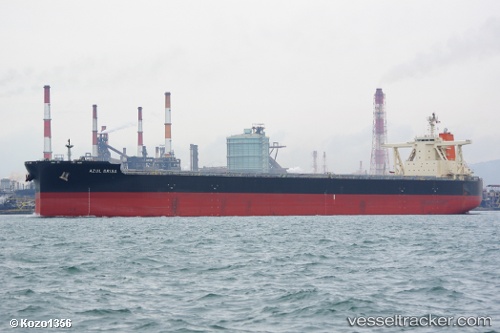
 Azul Brisa
Current Status
Where is the vessel?
Azul Brisa is currently in 12 nm N of Abbot Point, based on AIS data received about 15h ago.
Latest AIS update:
Current position: 19.69856° S, 148.11102° E (12 nm N of Abbot Point)
Average speed (last 7 days): Loading…
Average speed (last 30 days): Loading…
Vessel profile: Azul Brisa is a Bulk Carrier with dimensions 300m x 50m.
This page combines live AIS, route history, probable destination signals, nearby traffic, and port activity for practical vessel monitoring.
The current position of vessel Azul Brisa is -19.69856 lat / 148.11102 lng. Updated: 2026-05-24 07:49:31 UTCNearest reference points:
- Near AIRLIE
- Near Abell Point
- Near Whitsunday Island
Currently sailing under the flag of Japan ![]()
Details:
Live Vessel Azul Brisa Analytics (details, animations, etc.)
Recent AIS points (UTC):
2026-05-24 04:46:32 UTC · -19.69854, 148.11121 · SOG 0 kn · COG 99°2026-05-24 05:43:31 UTC · -19.69856, 148.11115 · SOG 0 kn · COG 98°
2026-05-24 07:28:31 UTC · -19.69862, 148.11102 · SOG 0.1 kn · COG 99°
2026-05-24 07:49:31 UTC · -19.69856, 148.11102 · SOG 0.1 kn · COG 101°