 vesseltracker.com
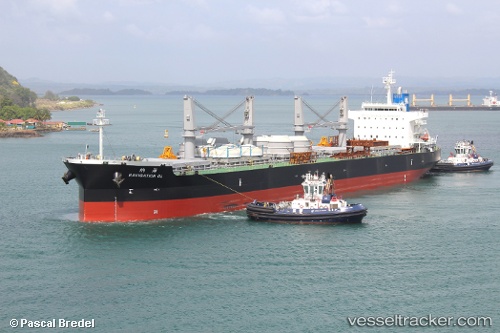
Navigation Ol
Current StatusWhere is the vessel?
Navigation Ol is currently in 23 nm W of Bayovar, based on AIS data received less than 1h ago.
Latest AIS update:
Current position: 5.90333° S, 81.45167° W (23 nm W of Bayovar)
Average speed (last 7 days): Loading…
Average speed (last 30 days): Loading…
Vessel profile: Navigation Ol is a Bulk Carrier with dimensions 32m x 199m.
This page combines live AIS, route history, probable destination signals, nearby traffic, and port activity for practical vessel monitoring.
The current position of vessel Navigation Ol is -5.90333 lat / -81.45167 lng. Updated: 2026-04-21 21:49:27 UTCNearest reference points:
- Near PAITA
- 75 nm SW of Talara
Details:
Live Vessel Navigation Ol Analytics (details, animations, etc.)
Recent AIS points (UTC):
2026-04-21 18:20:48 UTC · -5.28393, -81.53382 · SOG 10.6 kn · COG 172°2026-04-21 19:19:28 UTC · -5.45833, -81.51333 · SOG 10 kn · COG -1°
2026-04-21 20:07:49 UTC · -5.60065, -81.49699 · SOG 10.6 kn · COG 172°
2026-04-21 21:49:27 UTC · -5.90333, -81.45167 · SOG 11 kn · COG -1°