 vesseltracker.com
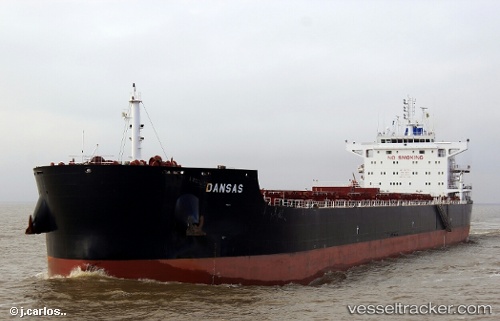
 TOMINI BRAVERY
Current Status
Where is the vessel?
TOMINI BRAVERY is currently in 199 nm N of Itarema, based on AIS data received about 4h ago.
Latest AIS update:
Current position: 0.32175° N, 39.16514° W (199 nm N of Itarema)
Average speed (last 7 days): Loading…
Average speed (last 30 days): Loading…
Vessel profile: TOMINI BRAVERY is a Bulk Carrier with dimensions 229m x 32m.
This page combines live AIS, route history, probable destination signals, nearby traffic, and port activity for practical vessel monitoring.
The current position of vessel TOMINI BRAVERY is 0.32175 lat / -39.16514 lng. Updated: 2026-04-04 03:53:44 UTCNearest reference points:
- 141 nm N of Itarema
- 169 nm N of Pecém Pt/São Gonçalo do Amarante
- 81 nm N of Acarau
Currently sailing under the flag of Marshall Islands ![]()
TOMINI BRAVERY built in 2015 year
Deadweight:
81027 tDetails:
Live Vessel TOMINI BRAVERY Analytics (details, animations, etc.)
Recent AIS points (UTC):
2026-04-03 23:11:15 UTC · 1.04533, -39.74601 · SOG 12 kn · COG 137°2026-04-04 01:55:17 UTC · 0.62758, -39.40830 · SOG 11.7 kn · COG 140°
2026-04-04 03:40:38 UTC · 0.35489, -39.19337 · SOG 11.9 kn · COG 138°
2026-04-04 03:53:44 UTC · 0.32175, -39.16514 · SOG 11.8 kn · COG 137°