 vesseltracker.com
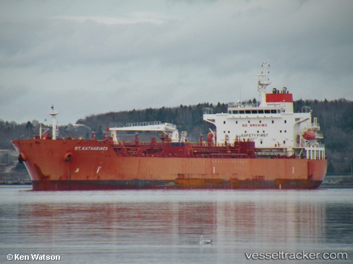
 St.katharinen
Current Status
Where is the vessel?
St.katharinen is currently in 186 nm SW of Gulfmex Lightering Area, based on AIS data received about 2h ago.
Latest AIS update:
Current position: 25.68833° N, 93.43333° W (186 nm SW of Gulfmex Lightering Area)
Average speed (last 7 days): Loading…
Average speed (last 30 days): Loading…
Vessel profile: St.katharinen is a Chemical Oil Products Tanker with dimensions 183m x 183m.
This page combines live AIS, route history, probable destination signals, nearby traffic, and port activity for practical vessel monitoring.
The current position of vessel St.katharinen is 25.68833 lat / -93.43333 lng. Updated: 2026-03-28 15:36:40 UTCNearest reference points:
- 124 nm SW of Gulfmex Lightering Area
- 94 nm S of Gulfmex Lightering Area
- 97 nm W of Gulfmex Lightering Area
Currently sailing under the flag of Singapore ![]()
St.katharinen built in 2013 year
Deadweight:
50259 tDetails:
Live Vessel St.katharinen Analytics (details, animations, etc.)
Recent AIS points (UTC):
2026-03-28 09:57:35 UTC · 26.61833, -92.90167 · SOG 12 kn · COG -1°2026-03-28 12:19:24 UTC · 26.17385, -93.04521 · SOG 11.3 kn · COG -1°
2026-03-28 13:24:57 UTC · 26.01048, -93.17964 · SOG 11.1 kn · COG -1°
2026-03-28 15:36:40 UTC · 25.68833, -93.43333 · SOG 10 kn · COG -1°