 vesseltracker.com
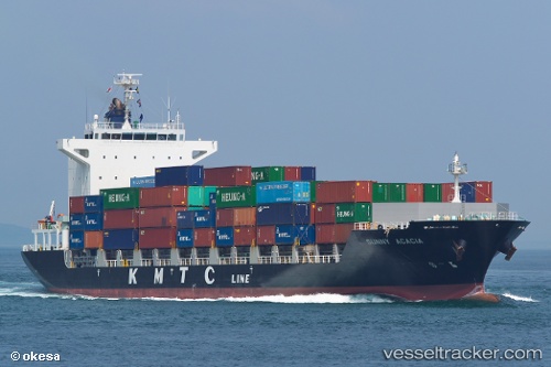
 SUNNY ACACIA
Current Status
Where is the vessel?
SUNNY ACACIA is currently in Near Yongdang-Dong, based on AIS data received about 1d ago.
Latest AIS update:
Current position: 35.10366° N, 129.07541° E (Near Yongdang-Dong)
Average speed (last 7 days): Loading…
Average speed (last 30 days): Loading…
Vessel profile: SUNNY ACACIA is a Cargo with dimensions m x m.
This page combines live AIS, route history, probable destination signals, nearby traffic, and port activity for practical vessel monitoring.
The current position of vessel SUNNY ACACIA is 35.10366 lat / 129.07541 lng. Updated: 2026-04-10 08:20:51 UTCNearest reference points:
- Near Busan
- Near Gamcheon/Busan
- Near Gijang-gun/Busan
Currently sailing under the flag of South Korea ![]()
Details:
Live Vessel SUNNY ACACIA Analytics (details, animations, etc.)
Recent AIS points (UTC):
2026-04-10 01:50:51 UTC · 35.10358, 129.07545 · SOG 0 kn · COG 90°2026-04-10 03:53:50 UTC · 35.10357, 129.07547 · SOG 0 kn · COG 90°
2026-04-10 05:41:50 UTC · 35.10361, 129.07549 · SOG 0 kn · COG 90°
2026-04-10 08:20:51 UTC · 35.10366, 129.07541 · SOG 0 kn · COG 90°