 vesseltracker.com
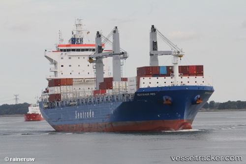
 CMA CGM RED
Current Status
Where is the vessel?
CMA CGM RED is currently in 55 nm SE of Pawleys Island, based on AIS data received about 1h ago.
Latest AIS update:
Current position: 32.86808° N, 78.25365° W (55 nm SE of Pawleys Island)
Average speed (last 7 days): Loading…
Average speed (last 30 days): Loading…
Vessel profile: CMA CGM RED is a Cargo with dimensions m x m.
This page combines live AIS, route history, probable destination signals, nearby traffic, and port activity for practical vessel monitoring.
The current position of vessel CMA CGM RED is 32.86808 lat / -78.25365 lng. Updated: 2026-03-27 15:30:03 UTCNearest reference points:
- Near North Myrtle Beach
- Near Charleston
- 33 nm S of Kiawah Island
Currently sailing under the flag of Malta ![]()
Details:
Live Vessel CMA CGM RED Analytics (details, animations, etc.)
Recent AIS points (UTC):
2026-03-27 09:40:57 UTC · 32.08243, -79.88765 · SOG 16.7 kn · COG 67°2026-03-27 11:56:15 UTC · 32.34082, -79.22603 · SOG 16.3 kn · COG 56°
2026-03-27 13:25:56 UTC · 32.57343, -78.83223 · SOG 16.5 kn · COG 54°
2026-03-27 15:30:03 UTC · 32.86808, -78.25365 · SOG 16.3 kn · COG 57°