 vesseltracker.com
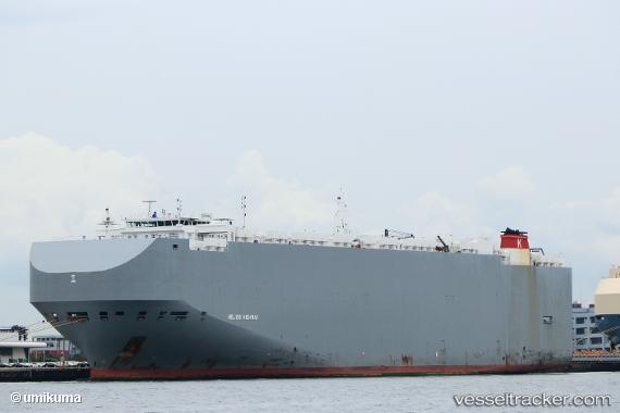
Helios Highway
Current StatusWhere is the vessel?
Helios Highway is currently in 35 nm E of Dai Hung (Tandem Load), based on AIS data received about 1h ago.
Latest AIS update:
Current position: 8.25833° N, 109.23500° E (35 nm E of Dai Hung (Tandem Load))
Average speed (last 7 days): Loading…
Average speed (last 30 days): Loading…
Vessel profile: Helios Highway is a Vehicles Carrier with dimensions 36m x 200m.
This page combines live AIS, route history, probable destination signals, nearby traffic, and port activity for practical vessel monitoring.
The current position of vessel Helios Highway is 8.25833 lat / 109.23500 lng. Updated: 2026-04-03 03:47:54 UTCNearest reference points:
- 30 nm SW of Dai Hung (Tandem Load)
- 41 nm NW of Brebes
- 11 nm N of Gombong
Details:
Live Vessel Helios Highway Analytics (details, animations, etc.)
Recent AIS points (UTC):
2026-04-02 21:41:50 UTC · 9.63500, 110.31500 · SOG 17 kn · COG -1°2026-04-02 23:50:50 UTC · 9.15167, 109.92667 · SOG 17 kn · COG -1°
2026-04-03 01:50:52 UTC · 8.70167, 109.57667 · SOG 16 kn · COG -1°
2026-04-03 03:47:54 UTC · 8.25833, 109.23500 · SOG 16 kn · COG -1°