 vesseltracker.com
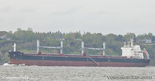
Iolaos
Current StatusWhere is the vessel?
Iolaos is currently in 223 nm NW of Johnston Island, based on AIS data received about 1h ago.
Latest AIS update:
Current position: 19.39370° N, 172.22632° W (223 nm NW of Johnston Island)
Average speed (last 7 days): Loading…
Average speed (last 30 days): Loading…
Vessel profile: Iolaos is a Bulk Carrier with dimensions 32m x 200m.
This page combines live AIS, route history, probable destination signals, nearby traffic, and port activity for practical vessel monitoring.
The current position of vessel Iolaos is 19.39370 lat / -172.22632 lng. Updated: 2026-04-02 16:18:51 UTCNearest reference points:
- Open sea, approx. 403 nm off the nearest listed port
- Open sea, approx. 408 nm off the nearest listed port
- Open sea, approx. 411 nm off the nearest listed port
Details:
Live Vessel Iolaos Analytics (details, animations, etc.)
Recent AIS points (UTC):
2026-04-02 09:23:11 UTC · 19.04675, -170.77235 · SOG 12.2 kn · COG 282°2026-04-02 11:54:10 UTC · 19.17353, -171.29977 · SOG 12.2 kn · COG 286°
2026-04-02 13:51:30 UTC · 19.27359, -171.70409 · SOG 12.3 kn · COG 283°
2026-04-02 16:18:51 UTC · 19.39370, -172.22632 · SOG 12.3 kn · COG 287°