 vesseltracker.com
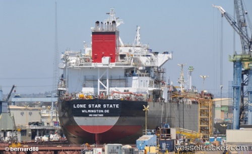
 Lonestar State
Current Status
Where is the vessel?
Lonestar State is currently in 137 nm S of Port Saint Joe, based on AIS data received about 1h ago.
Latest AIS update:
Current position: 27.59584° N, 85.99878° W (137 nm S of Port Saint Joe)
Average speed (last 7 days): Loading…
Average speed (last 30 days): Loading…
Vessel profile: Lonestar State is a Chemical Oil Products Tanker with dimensions 186m x 186m.
This page combines live AIS, route history, probable destination signals, nearby traffic, and port activity for practical vessel monitoring.
The current position of vessel Lonestar State is 27.59584 lat / -85.99878 lng. Updated: 2026-04-01 21:35:04 UTCNearest reference points:
- 62 nm SW of Anna Maria
- 58 nm SW of Suwannee
- 78 nm SW of Boca Grande
Currently sailing under the flag of USA ![]()
Details:
Live Vessel Lonestar State Analytics (details, animations, etc.)
Recent AIS points (UTC):
2026-04-01 15:40:43 UTC · 27.59345, -87.46983 · SOG 13.5 kn · COG 91°2026-04-01 18:19:38 UTC · 27.59508, -86.79019 · SOG 13.9 kn · COG 92°
2026-04-01 19:55:36 UTC · 27.59837, -86.36990 · SOG 13.8 kn · COG 94°
2026-04-01 21:35:04 UTC · 27.59584, -85.99878 · SOG 10.9 kn · COG -1°