 vesseltracker.com
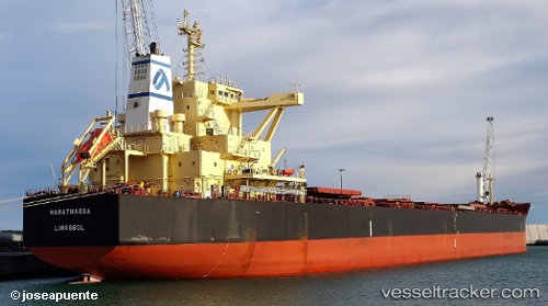
 MARATHASSA
Current Status
Where is the vessel?
MARATHASSA is currently in 85 nm S of Port Eads, based on AIS data received about 2h ago.
Latest AIS update:
Current position: 27.65139° N, 88.66392° W (85 nm S of Port Eads)
Average speed (last 7 days): Loading…
Average speed (last 30 days): Loading…
Vessel profile: MARATHASSA is a Cargo with dimensions m x m.
This page combines live AIS, route history, probable destination signals, nearby traffic, and port activity for practical vessel monitoring.
The current position of vessel MARATHASSA is 27.65139 lat / -88.66392 lng. Updated: 2026-03-27 15:26:21 UTCNearest reference points:
- Near Pilottown
- 13 nm NE of Pilottown
- Near Port Fourchon
Details:
Live Vessel MARATHASSA Analytics (details, animations, etc.)
Recent AIS points (UTC):
2026-03-27 09:36:20 UTC · 28.67863, -89.31230 · SOG 10.8 kn · COG -1°2026-03-27 11:55:35 UTC · 28.27489, -89.08410 · SOG 12.1 kn · COG 155°
2026-03-27 13:23:22 UTC · 28.01412, -88.90995 · SOG 12.5 kn · COG -1°
2026-03-27 15:26:21 UTC · 27.65139, -88.66392 · SOG 12.3 kn · COG -1°