 vesseltracker.com
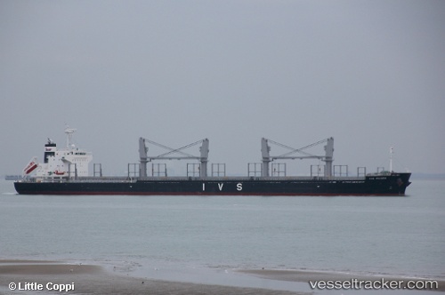
 NORD PHINDA
Current Status
Where is the vessel?
NORD PHINDA is currently in 19 nm S of Whyalla, based on AIS data received about 1h ago.
Latest AIS update:
Current position: 33.33671° S, 137.51907° E (19 nm S of Whyalla)
Average speed (last 7 days): Loading…
Average speed (last 30 days): Loading…
Vessel profile: NORD PHINDA is a Cargo with dimensions m x m.
This page combines live AIS, route history, probable destination signals, nearby traffic, and port activity for practical vessel monitoring.
The current position of vessel NORD PHINDA is -33.33671 lat / 137.51907 lng. Updated: 2026-04-18 17:39:29 UTCNearest reference points:
- Near North Haven
- Near Gillman
- Near Port Adelaide
Currently sailing under the flag of Marshall Islands ![]()
Details:
Live Vessel NORD PHINDA Analytics (details, animations, etc.)
Recent AIS points (UTC):
2026-04-18 11:49:28 UTC · -33.92164, 137.33611 · SOG 5.7 kn · COG 39°2026-04-18 13:55:19 UTC · -33.68588, 137.47137 · SOG 7.8 kn · COG 9°
2026-04-18 16:11:58 UTC · -33.45367, 137.50470 · SOG 4.6 kn · COG 353°
2026-04-18 17:39:29 UTC · -33.33671, 137.51907 · SOG 5.3 kn · COG 15°