 vesseltracker.com
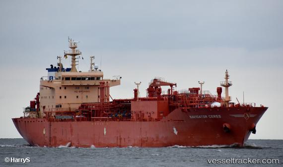
 Navigator Ceres
Current Status
Where is the vessel?
Navigator Ceres is currently in 22 nm SE of Honolulu, based on AIS data received less than 1h ago.
Latest AIS update:
Current position: 21.03770° N, 157.56995° W (22 nm SE of Honolulu)
Average speed (last 7 days): Loading…
Average speed (last 30 days): Loading…
Vessel profile: Navigator Ceres is a Lpg Tanker with dimensions 160m x 25m.
This page combines live AIS, route history, probable destination signals, nearby traffic, and port activity for practical vessel monitoring.
The current position of vessel Navigator Ceres is 21.03770 lat / -157.56995 lng. Updated: 2026-03-30 10:14:24 UTCNearest reference points:
- Near Honolulu
- Near Kaunakakai
- 132 nm SW of Barbers Point
Currently sailing under the flag of Liberia ![]()
Details:
Live Vessel Navigator Ceres Analytics (details, animations, etc.)
Recent AIS points (UTC):
2026-03-30 04:20:19 UTC · 21.03780, -157.56976 · SOG 0.2 kn · COG 36°2026-03-30 05:32:24 UTC · 21.03834, -157.57056 · SOG 0.2 kn · COG 59°
2026-03-30 07:35:19 UTC · 21.03805, -157.57014 · SOG 1.3 kn · COG 53°
2026-03-30 10:14:24 UTC · 21.03770, -157.56995 · SOG 0.9 kn · COG 15°