 vesseltracker.com
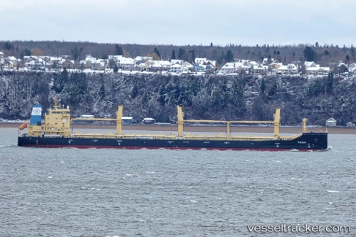
Tanja
Current StatusWhere is the vessel?
Tanja is currently in 71 nm SW of Tatoosh Island, based on AIS data received less than 1h ago.
Latest AIS update:
Current position: 47.73535° N, 126.21838° W (71 nm SW of Tatoosh Island)
Average speed (last 7 days): Loading…
Average speed (last 30 days): Loading…
Vessel profile: Tanja is a Bulk Carrier with dimensions 23m x 185m.
This page combines live AIS, route history, probable destination signals, nearby traffic, and port activity for practical vessel monitoring.
The current position of vessel Tanja is 47.73535 lat / -126.21838 lng. Updated: 2026-04-04 01:36:23 UTCNearest reference points:
- 21 nm NW of Tatoosh Island
- Near Clallam Bay
- Near Grays Harbor City
Details:
Live Vessel Tanja Analytics (details, animations, etc.)
Recent AIS points (UTC):
2026-04-03 19:48:57 UTC · 47.11500, -127.24833 · SOG 11 kn · COG -1°2026-04-03 21:18:56 UTC · 47.29833, -126.92667 · SOG 11 kn · COG -1°
2026-04-03 23:15:57 UTC · 47.53333, -126.52833 · SOG 11 kn · COG -1°
2026-04-04 01:36:23 UTC · 47.73535, -126.21838 · SOG 10.8 kn · COG 51°