 vesseltracker.com
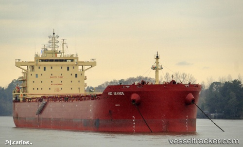
 PANAGIA S
Current Status
Where is the vessel?
PANAGIA S is currently in 245 nm E of Diego Garcia, based on AIS data received less than 1h ago.
Latest AIS update:
Current position: 8.84711° S, 76.28205° E (245 nm E of Diego Garcia)
Average speed (last 7 days): Loading…
Average speed (last 30 days): Loading…
Vessel profile: PANAGIA S is a Cargo with dimensions m x m.
This page combines live AIS, route history, probable destination signals, nearby traffic, and port activity for practical vessel monitoring.
The current position of vessel PANAGIA S is -8.84711 lat / 76.28205 lng. Updated: 2026-04-19 16:50:39 UTCNearest reference points:
- 284 nm E of Diego Garcia
- 208 nm E of Diego Garcia
- Open sea, approx. 404 nm off the nearest listed port
Currently sailing under the flag of Liberia ![]()
Details:
Live Vessel PANAGIA S Analytics (details, animations, etc.)
Recent AIS points (UTC):
2026-04-19 12:56:08 UTC · -8.44452, 76.88856 · SOG 10.7 kn · COG 235°2026-04-19 13:33:30 UTC · -8.49787, 76.78817 · SOG 10.5 kn · COG 237°
2026-04-19 16:26:19 UTC · -8.80298, 76.34350 · SOG 11.4 kn · COG 228°
2026-04-19 16:50:39 UTC · -8.84711, 76.28205 · SOG 11.2 kn · COG 232°