 vesseltracker.com
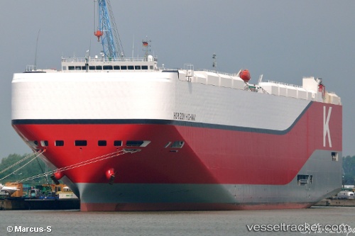
 Horizon Highway
Current Status
Where is the vessel?
Horizon Highway is currently in 185 nm NE of Kairuku, based on AIS data received about 1h ago.
Latest AIS update:
Current position: 11.14202° N, 148.61095° E (185 nm NE of Kairuku)
Average speed (last 7 days): Loading…
Average speed (last 30 days): Loading…
Vessel profile: Horizon Highway is a Vehicles Carrier with dimensions 199m x 38m.
This page combines live AIS, route history, probable destination signals, nearby traffic, and port activity for practical vessel monitoring.
The current position of vessel Horizon Highway is 11.14202 lat / 148.61095 lng. Updated: 2026-03-29 05:56:10 UTCNearest reference points:
- 169 nm N of Kairuku
Currently sailing under the flag of Panama ![]()
Details:
Live Vessel Horizon Highway Analytics (details, animations, etc.)
Recent AIS points (UTC):
2026-03-28 23:32:47 UTC · 12.68256, 148.22218 · SOG 17.6 kn · COG 166°2026-03-29 00:28:18 UTC · 12.41667, 148.28500 · SOG 17 kn · COG -1°
2026-03-29 03:54:44 UTC · 11.71544, 148.46025 · SOG 17.7 kn · COG 163°
2026-03-29 05:56:10 UTC · 11.14202, 148.61095 · SOG 17.3 kn · COG 162°