 vesseltracker.com
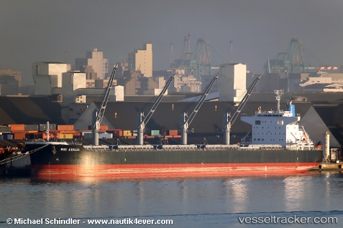
 RED AZALEA
Current Status
Where is the vessel?
RED AZALEA is currently in 22 nm N of Fermanville, based on AIS data received less than 1h ago.
Latest AIS update:
Current position: 50.05058° N, 1.53636° W (22 nm N of Fermanville)
Average speed (last 7 days): Loading…
Average speed (last 30 days): Loading…
Vessel profile: RED AZALEA is a Cargo with dimensions m x m.
This page combines live AIS, route history, probable destination signals, nearby traffic, and port activity for practical vessel monitoring.
The current position of vessel RED AZALEA is 50.05058 lat / -1.53636 lng. Updated: 2026-04-08 10:04:50 UTCNearest reference points:
- 22 nm S of Holbury
- 20 nm S of Holbury
- 24 nm N of Fermanville
Currently sailing under the flag of Liberia ![]()
Details:
Live Vessel RED AZALEA Analytics (details, animations, etc.)
Recent AIS points (UTC):
2026-04-08 03:59:40 UTC · 49.76481, -3.30454 · SOG 10.7 kn · COG 80°2026-04-08 06:27:15 UTC · 49.85334, -2.64844 · SOG 10.9 kn · COG 72°
2026-04-08 08:18:00 UTC · 49.95182, -2.12772 · SOG 12.3 kn · COG 72°
2026-04-08 10:04:50 UTC · 50.05058, -1.53636 · SOG 14.1 kn · COG 73°